The proposed shift of maritime traffic from the Iranian-controlled northern sectors of the Strait of Hormuz to the Omani-managed southern territorial waters represents a fundamental restructuring of Persian Gulf logistics. This maneuver is not merely a diplomatic gesture; it is a calculated attempt to decouple physical transit security from regional political volatility. To understand the viability of "free passage" through Omani waters, one must dissect the mechanism of the Traffic Separation Scheme (TSS), the bathymetric constraints of the Musandam Peninsula, and the economic friction points that currently dictate global energy flows.
The Mechanics of Strait Geometry and Sovereign Limits
The Strait of Hormuz functions as a 21-nautical-mile-wide choke point where the inbound and outbound shipping lanes—each two miles wide—are separated by a two-mile buffer zone. Under the United Nations Convention on the Law of the Sea (UNCLOS), these lanes fall within the territorial waters of Iran and Oman. However, the legal doctrine of "transit passage" grants international vessels the right to navigate these waters unimpeded, provided they remain in continuous and expeditious transit.
The Iranian proposal to offer "free passage" through the Omani side essentially suggests a voluntary redirection of the TSS. For this to manifest, three technical hurdles must be cleared:
- Bathymetric Sufficiency: The southern reaches of the Strait, specifically around the Quoin Islands (As Salamah), feature jagged underwater topography. While deep enough for Ultra Large Crude Carriers (ULCCs), the navigational margin of error is significantly slimmer than the Iranian northern routes.
- Regulatory Harmonization: The International Maritime Organization (IMO) manages the TSS. A unilateral shift by Iran cannot legally alter the globally recognized coordinates of shipping lanes without a coordinated filing with the IMO, involving Omani consent.
- Insurance Risk Premiums: The Joint War Committee (JWC) of the London insurance market designates the Persian Gulf as a "Listed Area." Redirecting ships into Omani waters does not inherently remove the risk of kinetic interference or limpet mine attachment unless the physical distance from Iranian naval assets is sufficient to neutralize boarding capabilities.
The Triad of Maritime Friction
The efficacy of any transit through the Strait of Hormuz is governed by three primary variables: kinetic security, regulatory overhead, and operational insurance costs.
The Security Variable
Vessels currently navigating the northern lanes are subject to the jurisdiction of the Islamic Revolutionary Guard Corps Navy (IRGCN). By moving traffic south, the primary objective is to place a sovereign buffer—Oman—between the commercial fleet and Iranian naval patrols. However, the physical proximity remains tight. The "Omani side" is still within the radar and missile envelope of Iranian coastal batteries on Qeshm and Larak Islands. Therefore, the "free passage" offer functions more as a promise of non-interference rather than a geographical escape.
The Regulatory Variable
The Strait handles roughly 20-30% of the world's total consumption of liquid petroleum. Any change in the flow pattern introduces "slop" into the global supply chain. If tankers are forced to utilize a single-sided passage or a condensed Omani lane, the density of traffic increases the probability of maritime accidents. This creates a "congestion tax"—a hidden cost characterized by reduced speeds and increased fuel consumption.
The Insurance Variable
Marine hull and machinery (H&M) and Protection and Indemnity (P&I) insurance are sensitive to "state-actor risk." Even if passage is free in terms of tolls or fees, it is never free in terms of risk. The market prices the probability of seizure. A move to Omani waters only lowers premiums if the international community perceives Oman as having the military and diplomatic capacity to enforce the inviolability of its waters against external boarding parties.
The Bathymetry of Power
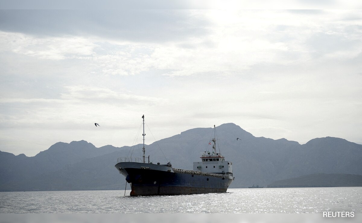
A critical oversight in standard reporting is the physical limitation of the seabed. The northern (Iranian) side of the Strait typically offers deeper, more uniform channels for deep-draft tankers. The southern (Omani) side is constrained by the Musandam Peninsula’s "sunken mountain" geography.
$D_{required} = T + M_{s} + C_{a}$
In the formula above, the required depth ($D_{required}$) for a vessel must account for the static draft ($T$), a safety margin ($M_{s}$), and the "squat" effect ($C_{a}$) which occurs when a vessel moves through shallow water at speed. In the tighter Omani channels, ULCCs may be forced to reduce speed to minimize squat, directly impacting the throughput of the Strait. This physical reality means that "free passage" comes at the cost of "slower passage."
Strategic Decoupling or Tactical Feint
The proposal suggests a strategic pivot where Iran attempts to normalize its regional presence by offloading the burden of maritime security—and the potential for friction—onto Oman. This creates a dual-track reality:
- For Oman: The Sultanate gains increased leverage as the primary gatekeeper of the Gulf, but it also inherits the massive security overhead of patrolling an intensified shipping lane.
- For International Shippers: The move offers a "Plan B" that avoids Iranian territorial waters entirely, potentially lowering the legal pretext for Iranian seizures based on domestic maritime law violations.
However, the "Omani alternative" is not a panacea. If the IRGCN chooses to project power into the buffer zone, the distinction between northern and southern lanes becomes moot. The strategic value of the proposal lies in its ability to de-escalate tension by creating a "neutral corridor" managed by a state—Oman—that maintains functional relationships with both Tehran and Washington.
The Cost Function of Redirection
Evaluating the economic impact requires looking beyond the price of a barrel of oil. The true cost of redirecting the Strait's traffic is found in the Long-Range Interruption Factor (LRIF).
The LRIF accounts for:
- Increased Transit Time: Adding even 4 hours to a transit for 20 vessels per day equates to 80 lost hours of operational time daily across the fleet.
- Escort Requirements: If the southern lane is perceived as vulnerable, the cost of private maritime security companies (PMSCs) or state-led naval escorts (Operation Prosperity Guardian equivalents) increases.
- Bunkerage Costs: Slower speeds and longer routes increase the "burn rate" of low-sulfur fuel oil, which has seen volatile pricing since the IMO 2020 regulations.
The "free" nature of the Iranian offer is therefore a misnomer. It is a trade-off where the removal of political risk is exchanged for increased operational and technical risk.
Structural Bottlenecks in the Musandam Corridor
The Musandam Peninsula is one of the most rugged coastal environments on earth. The logistical infrastructure required to monitor a high-density Omani-side-only transit is currently insufficient. To elevate this proposal from a report to a masterclass in regional strategy, the following infrastructure upgrades would be mandatory:
- VTS Expansion: The Vessel Traffic Service (VTS) centers in Khasab and Muscat would require a massive infusion of sensor technology and AIS (Automatic Identification System) terrestrial stations to manage the condensed traffic.
- Emergency Response: The capability to manage a Tier 3 oil spill or a disabled VLCC (Very Large Crude Carrier) in the narrower Omani lanes is currently limited.
Without these upgrades, a surge in southern-lane traffic creates a "fragility trap" where a single mechanical failure or minor collision could effectively close the Strait to deep-draft vessels.
The Geopolitical Arbitrage Play
Iran’s move is a masterclass in geopolitical arbitrage. By offering "free passage" through Omani waters, Tehran is signaling that it is not the impediment to global trade, but rather a flexible actor willing to facilitate alternatives. This puts the onus on the West and the GCC to either accept the Omani-centric model—thereby validating a shift in regional power dynamics—or reject it and remain tethered to the high-friction Iranian lanes.
The pivot to Omani waters is a technological and navigational challenge masquerading as a diplomatic olive branch. It tests the limits of maritime law and the physical capacity of the Musandam coastline.
The strategic play for global energy stakeholders is not to move all traffic south immediately, but to utilize the Omani corridor as a high-frequency testing ground for autonomous transit and enhanced VTS monitoring. By establishing a "Gold Standard" of Omani-managed passage, the international community can effectively bypass Iranian jurisdictional triggers while forcing a technological upgrade of the world’s most critical maritime artery. The move should be viewed as the first step in a "De-risking" protocol that seeks to make the Strait of Hormuz a neutral utility rather than a sovereign weapon.